Our platforms
Decision intelligence for water and the environment
Select from our suite of AI-powered platforms — or let us tailor a modular solution to your organisation's unique requirements.
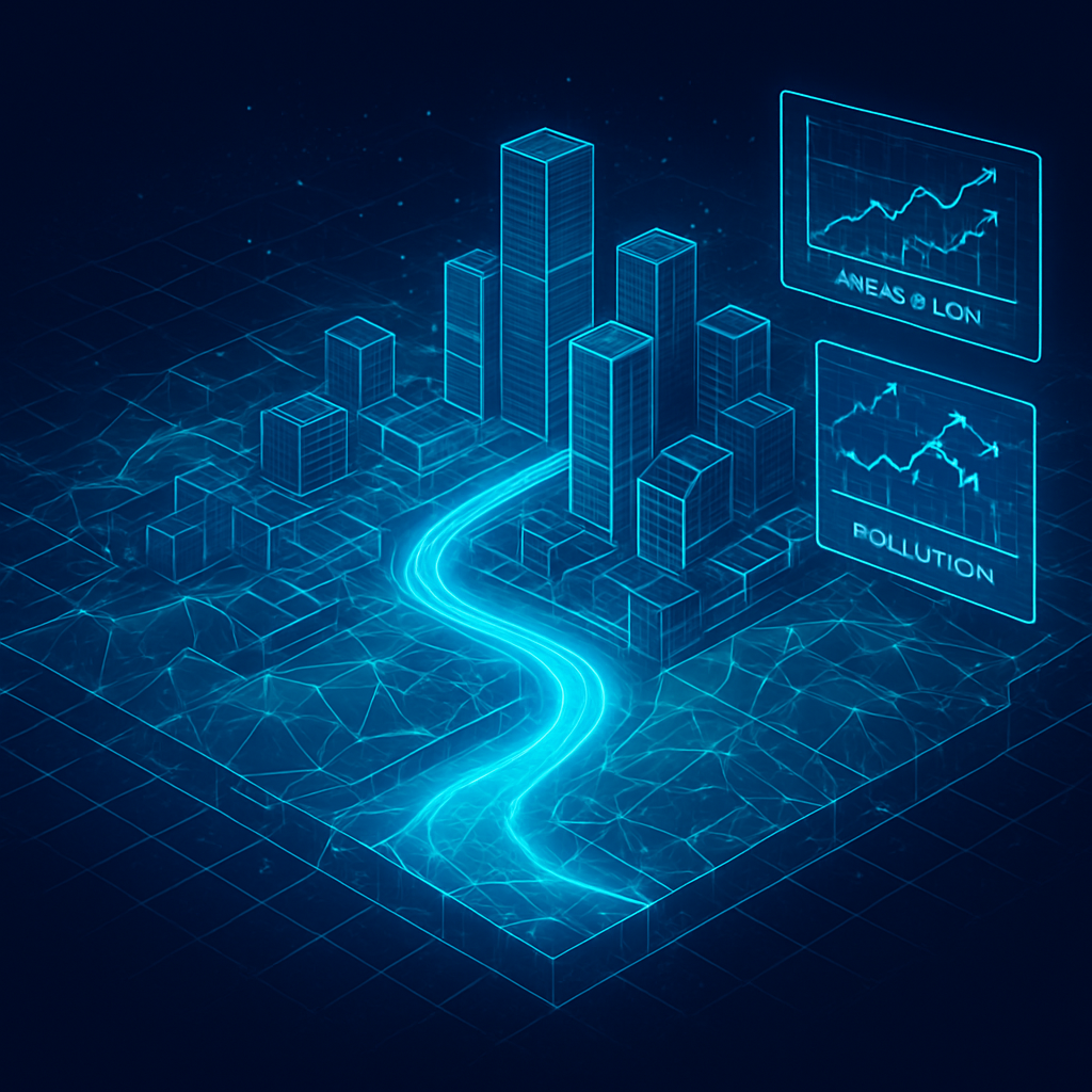
Airnomik©
Transforming Water Resource Management with Data-Driven Analytics
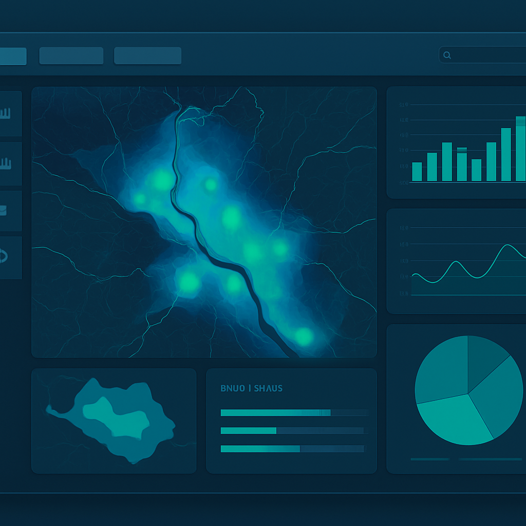
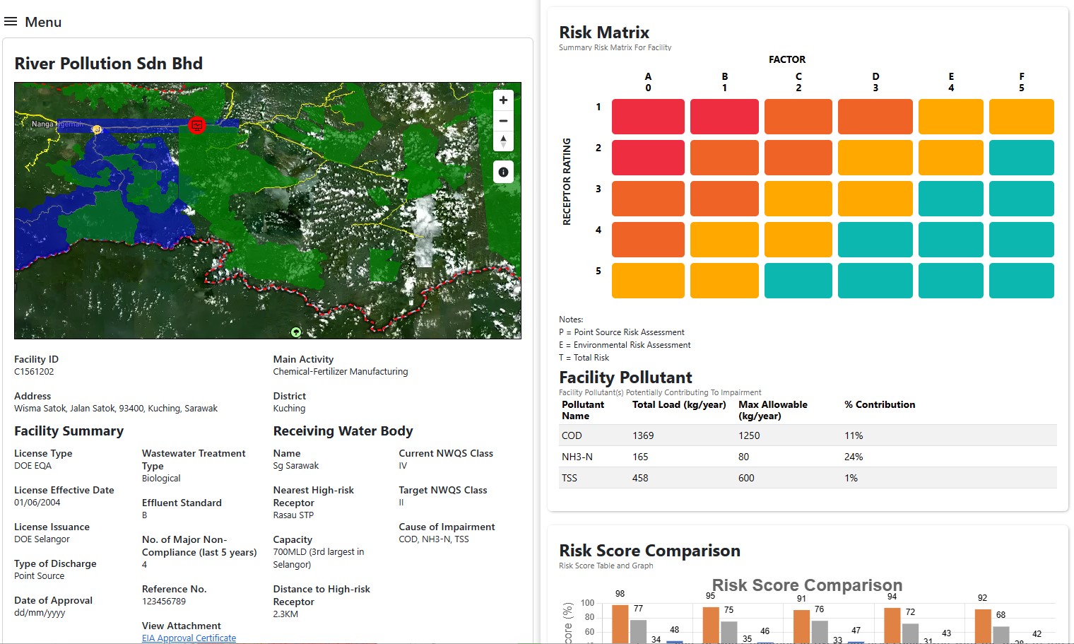
A spatial decision support system powered by AI and environmental data integration — enabling dynamic modelling of pollution sources, hydrological pathways, cumulative pollutant loads and river assimilative capacity across an entire river basin.
- Digital twin of the river basin
- Pollution load allocation and hotspot analysis
- AI-driven risk screening and compliance monitoring
- Real-time data integration for adaptive planning
Airnomik©
Navigating Climate Complexities, Crafting a Resilient Future
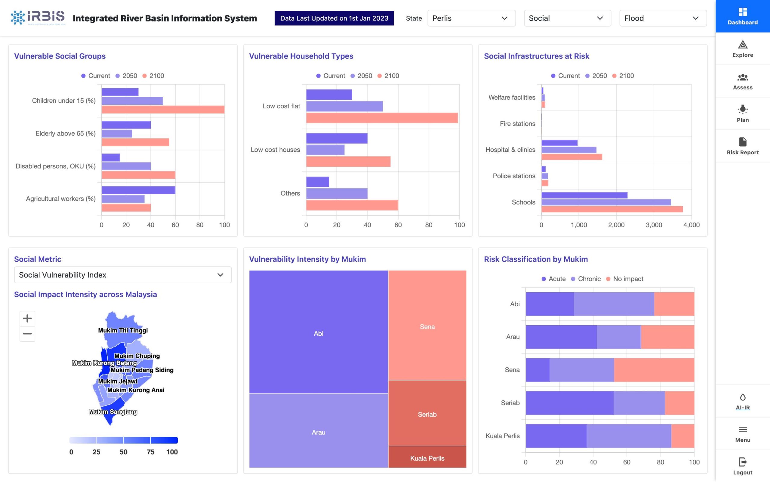
An integrated river basin information system bringing together hydrological, land-use and climate data to support coordinated, basin-scale planning and decision-making.
- Integrated river basin data management
- Land use and infrastructure integration
- Scenario planning and visualisation
- Stakeholder coordination tools
Airnomik©
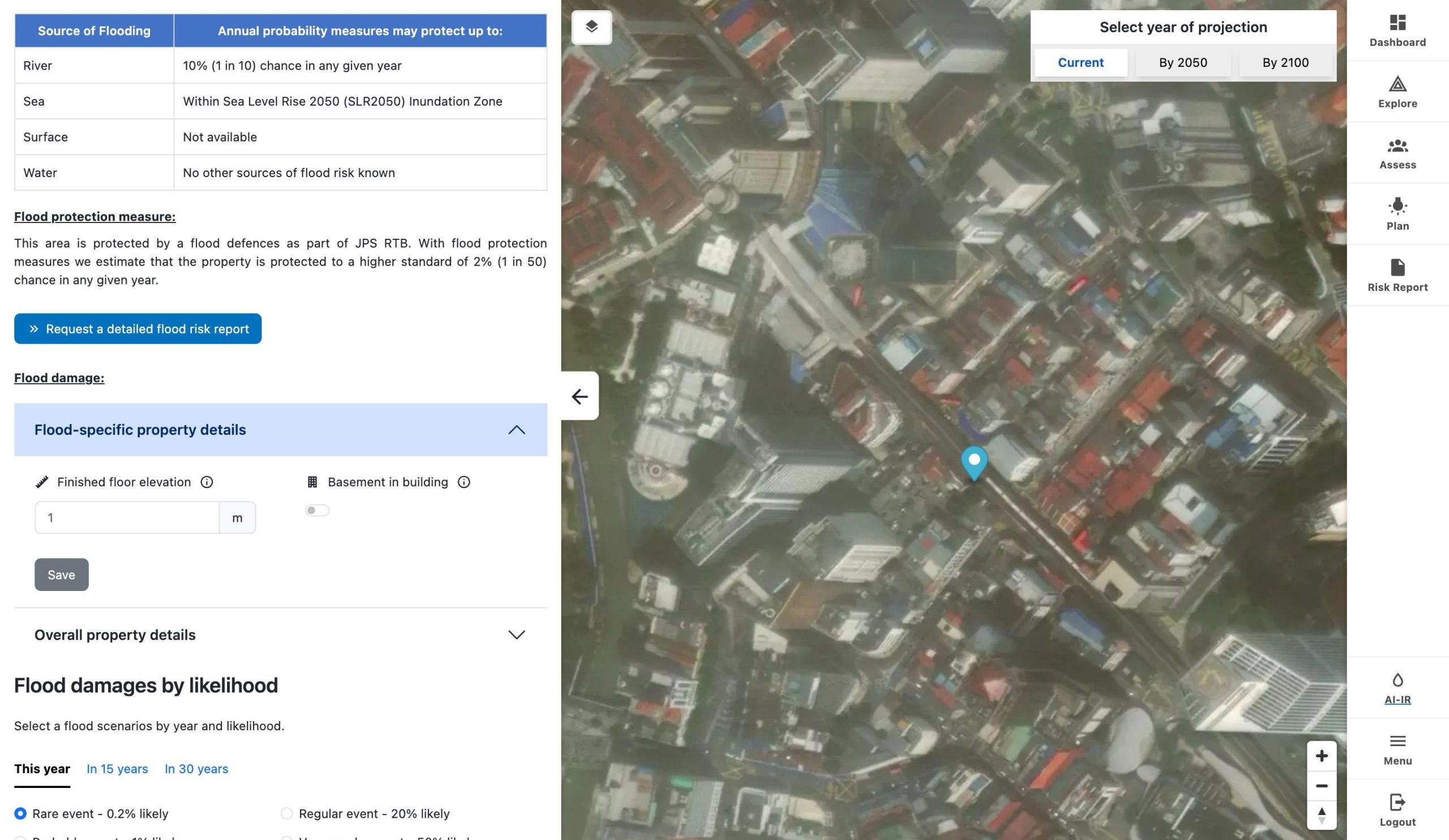
Climate Change Physical Risk Assessment
Asset-level physical climate risk reporting that translates hazard, exposure and vulnerability data into clear, decision-ready insights aligned with TCFD disclosure.
- Flood, drought and heat hazard screening
- Asset-level physical risk scoring
- Scenario-based projections
- TCFD-aligned reporting outputs
How we turn complex data into resilient strategy
Our decision-support workflow integrates environmental science with digital innovation to deliver predictive, evidence-based insights.

Data Integration
Remote sensing, IoT sensors, hydrological and climate datasets unified into one pipeline.

AI & GIS Analytics
Machine learning, geospatial analysis and predictive modelling extract spatial intelligence.
Digital Twin
A living model of the river basin simulates pollution loads, flows and risk scenarios.

Decision Support
Dashboards and reports turn insight into compliant, actionable strategy.
How we assess climate risk
We model risk as the interaction of three dimensions — translating climate hazards into clear, decision-ready insight for communities, infrastructure and ecosystems.
Hazard
We screen the full spectrum of climate-driven threats — from floods and drought to coastal inundation, erosion, water quality and fire — modelling their intensity, frequency and spatial footprint.
Exposure
We map the people, assets, infrastructure and ecosystems located in hazard-prone areas to quantify what is at stake under each scenario.
Vulnerability
We assess sensitivity and adaptive capacity to determine how severely exposed systems are affected — and where resilience can be strengthened.
Climate Risk
A quantified, spatial view of risk that pinpoints where to act and where resilience can be strengthened.
Ready to transform your environmental data?
Let us help you turn complex water, climate and infrastructure data into clear, actionable strategies. Talk to our team about your challenge today.